Free Download!
Free Download!
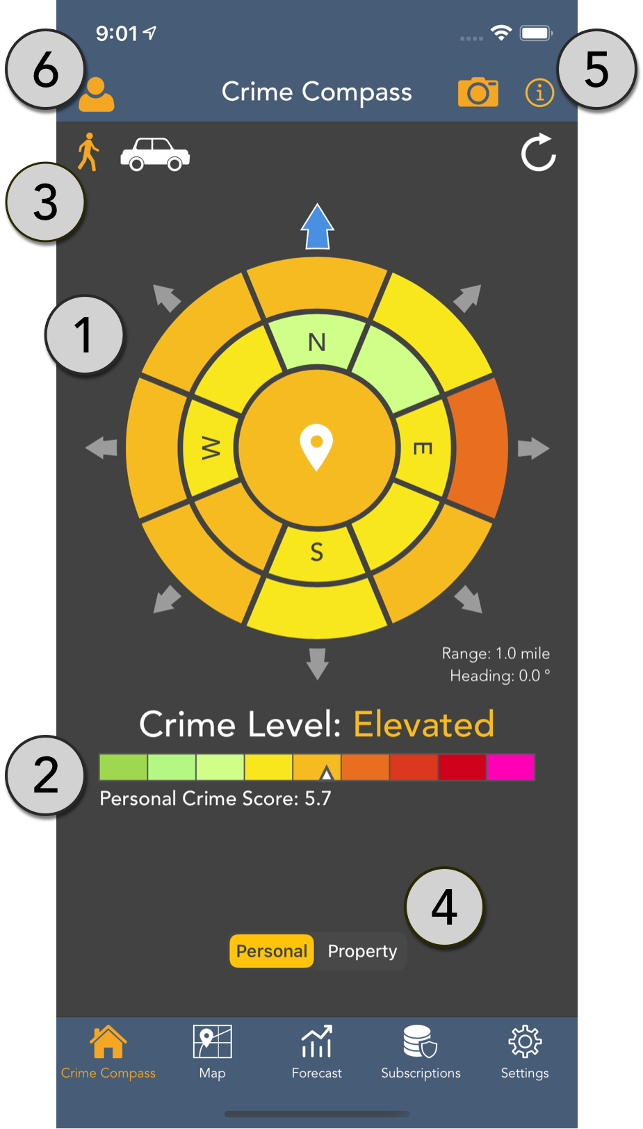
The Crime Compass is a unique color coded view that allows you to quickly see your surroundings as you move, and updates dynamically using a combination of the device's GPS and internal compass hardware.
Inner and outer concentric rings show short-range and longer-range crime hotspots respectively. The maximum range can be configured from the Settings screen, with each of the two rings displaying half the specified range.
The overall Personal or Property crime score and level for the current location, with a color scale showing the full range of scores.
Switch between the device’s internal compass heading (“Heading mode”), or GPS course (“Course mode”). Heading mode is more natural when the device is handheld, and Course mode is a better choice when riding in a vehicle or moving quickly.
Users with sufficient screen real estate (iPhone 6 and higher) will be able to switch directly between Personal crime and Property crime views, while other users can make this change from the Settings screen.
Tap the camera to take a snapshot of the current screen, then save or share it conveniently. Tap the “i” symbol at the top of any screen to display a helpful walkthrough of the app’s main features.
Tap to show the user logged in and sign out if desired.
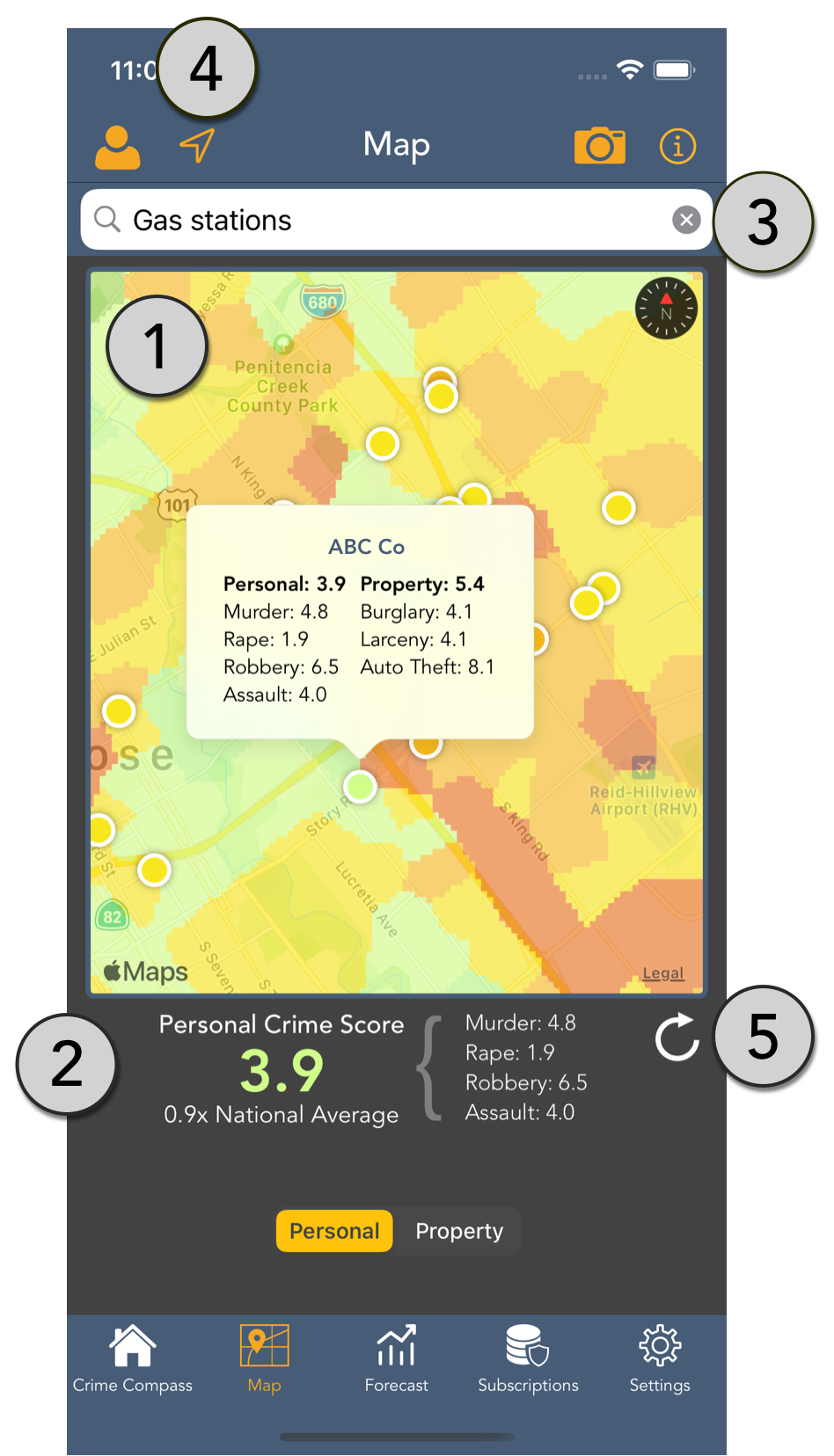
The Map Overlay displays crime data as a fully interactive heat map with GPS tracking indicating your current location.
The map may be panned, rotated, and zoomed in or out while continuously displaying crime data for different geographies. A long press drops a custom pin displaying full crime metrics for that location.
The data below the map displays scores for each crime metric, in addition to the overall Personal or Property crime score for the current location. Users may also configure a reference score (e.g. My house) to display in this area (see the Settings section below for more information).
The search bar may be used to seek out addresses or points of interest. In each case, a color coded annotation will be added to the map to quickly display the level of crime at the sought location. Touching on an annotation will display the full set of metrics.
Similar to built-in Apple Maps functionality, the arrow shaped button at the top left of the screen can be used to toggle whether, and how the map follows the user’s current location.
Tapping the refresh icon will clear all dropped pins from the map.
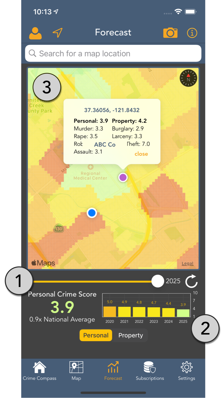
The map overlay and a convenient graph show 1 to 5 year crime projections for the current location, or any selected location such as a dropped pin, or selected search.
The forecast slider may be used to select the desired forecast year, from the current year’s crime data to 5 years in the future. The map overlay and all crime scores will dynamically change to show projections for that year.
A convenient graph shows 5 year projections for the current location, or any selected location such as a dropped pin, or selected search result. Selecting a bar on the graph will show crime metrics for that year.
Similar to the Map Overlay, the map may be panned, rotated, and zoomed in or out while continuously displaying crime data for different geographies. Selecting searched locations, or dropped pins will update crime scores and the forecast graph for that location.
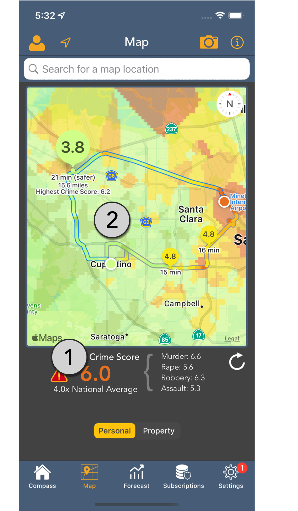
Crime aware trip planning is available to any searched or custom location. Routes are displayed and color-coded based on an aggregate of crime scores encountered during the trip.
Safer routes are highlighted in blue.
Each route has a pin that displays the average crime score along the route. Tapping the pin will display additional information and show the highest crime score encountered during the route.